NOAA Buoy Reports - Live Buoy & Ship Data
NOAA Buoy Reports™ provides real-time buoy and ship observations from NOAA stations worldwide. View wind, waves, pressure, temperature, and historical graphs on an interactive map - ideal for sailors, boaters, and marine professionals.
NOAA Buoy Reports Includes
- Intuitive map interface
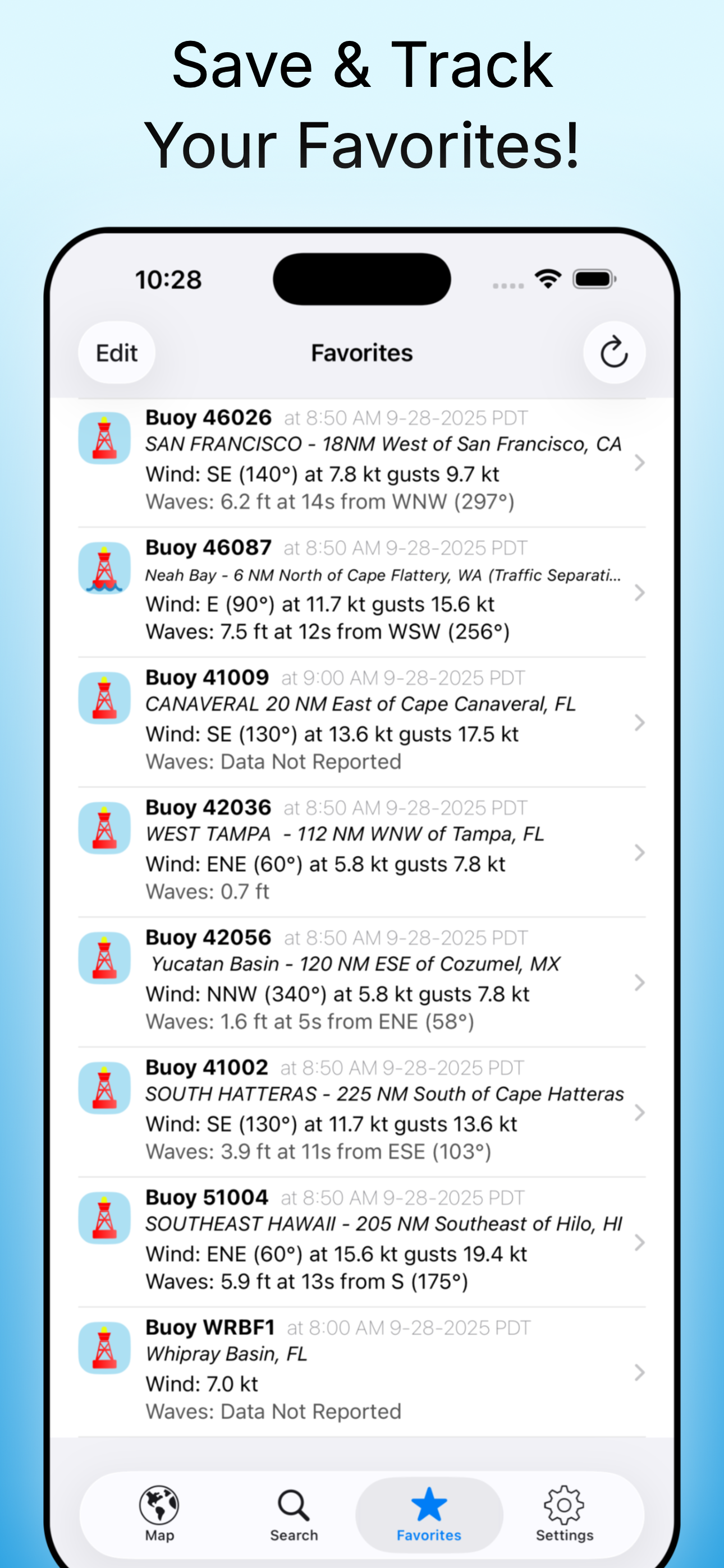
- Quick-view Favorites
- Locations of Tropical Storms, Hurricanes, and Cyclones from the NHC
- Full buoy current conditions (always free)
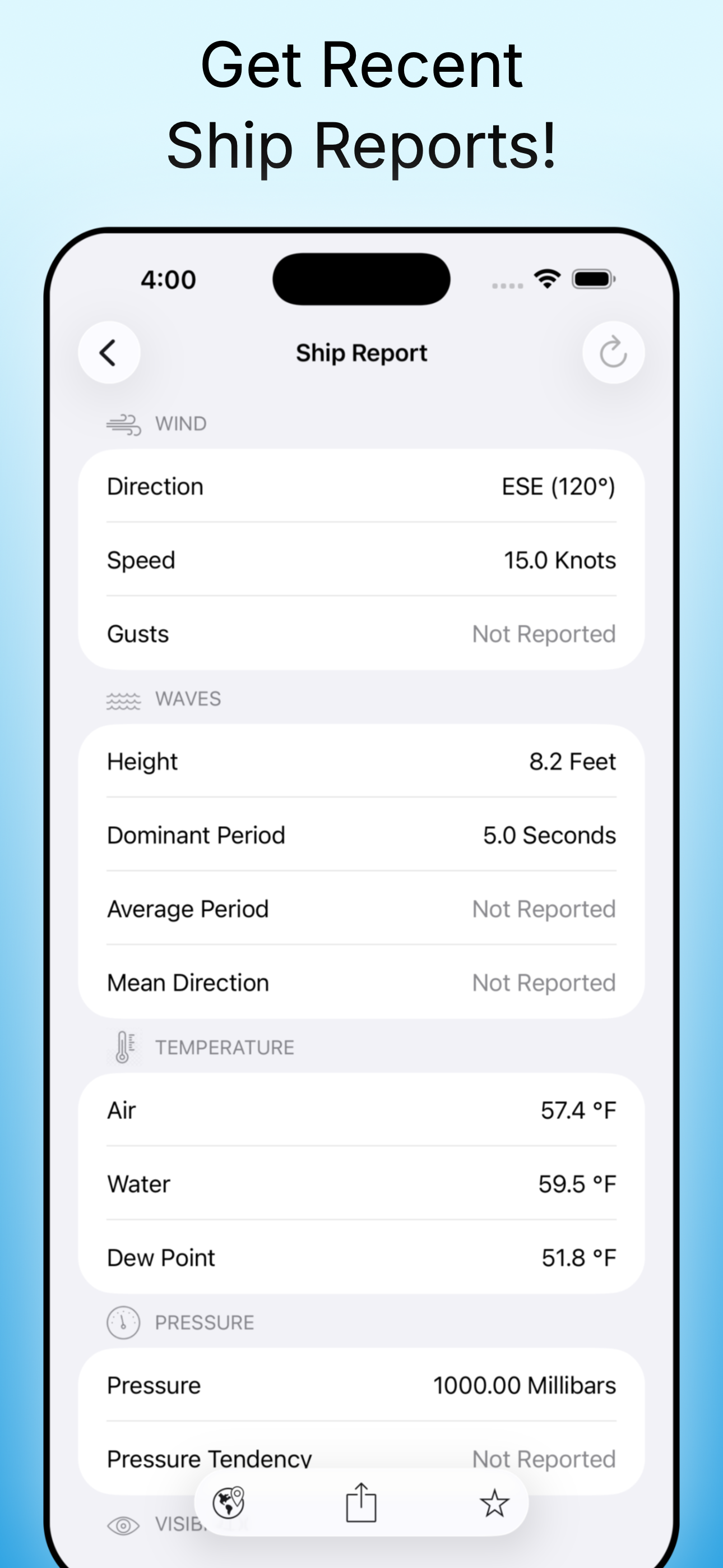
- Ship observations (free preview)
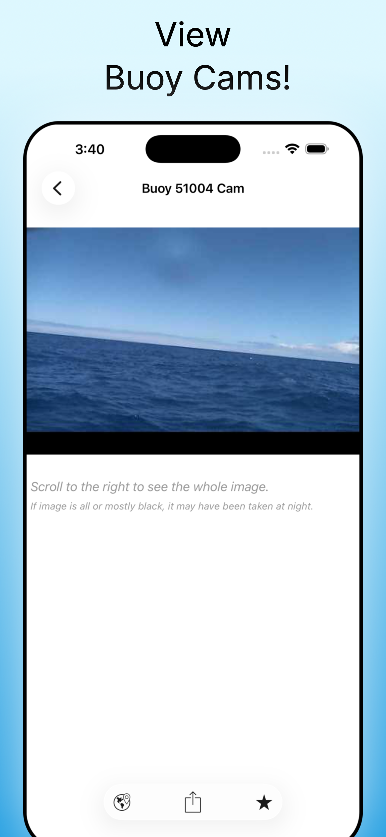
- Buoy Cams (free preview)
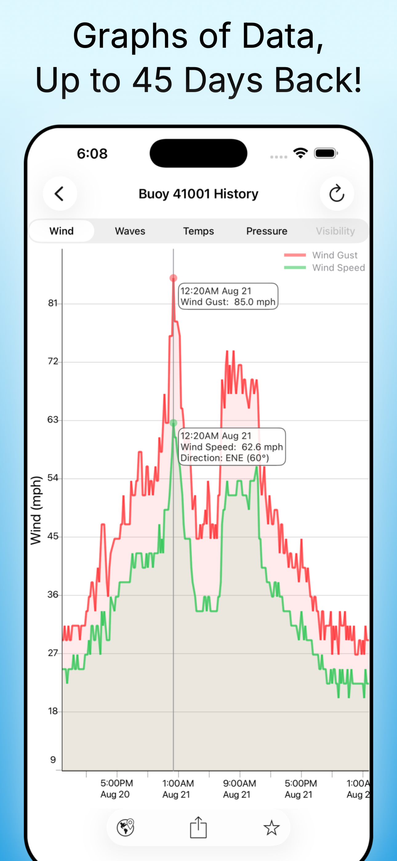
- Past buoy data up to 45 days (Upgrade Required)
- Wave heights and directions (when available)
- Wind, gusts, and directions (when available)
- Air and Water temperatures (when available)
- Atmospheric pressure (when available)
- Interactive graphs
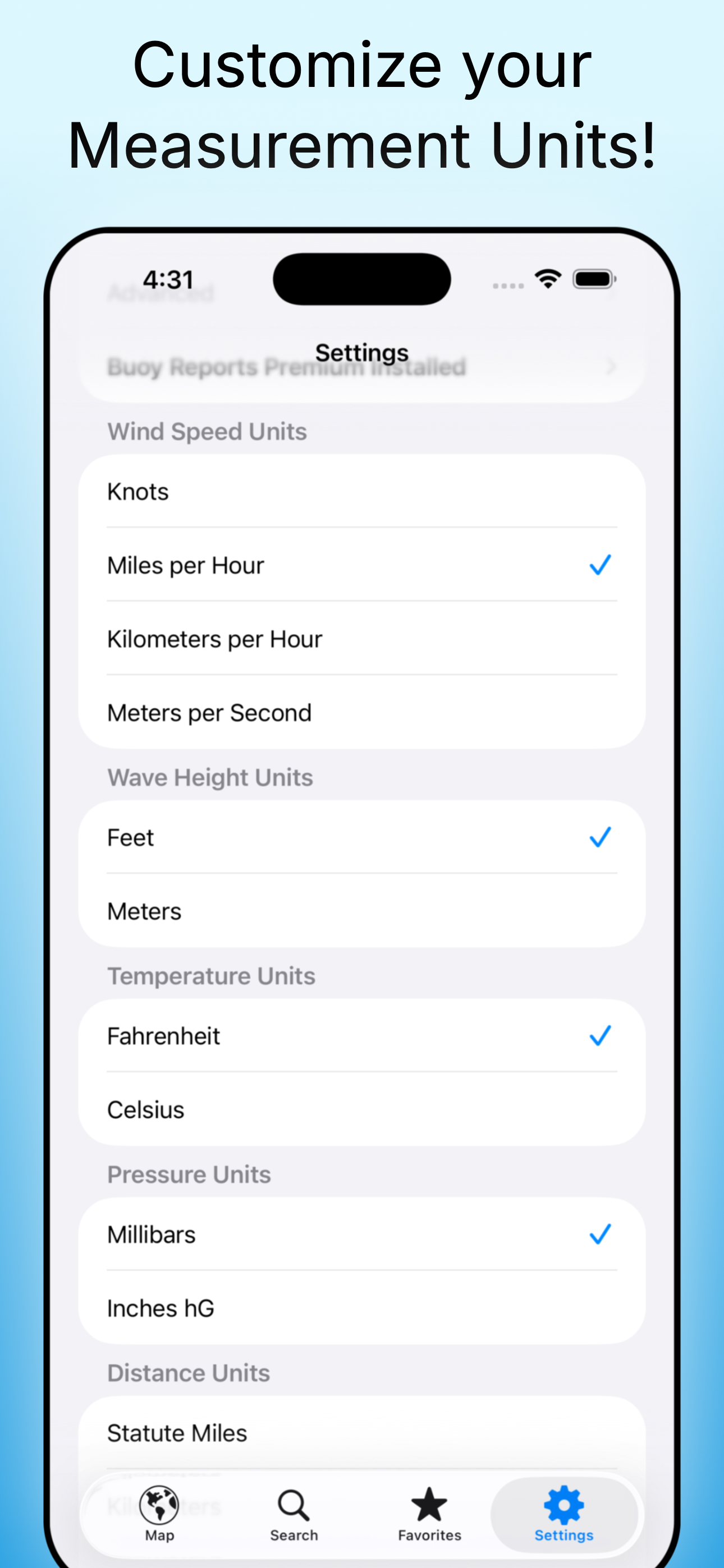
- Units in Metric or English
- Readings in your local time
- Share graphs via Message, Email, Facebook, and more
- Dark Mode support
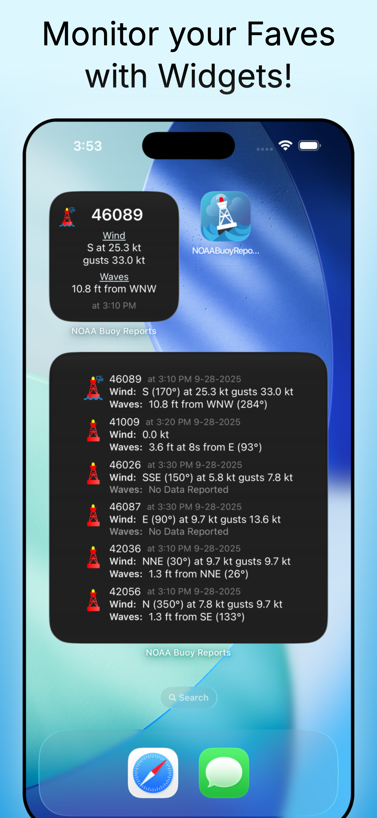
- Widgets to monitor your favorites
Reports from over 1,000 buoys and more than 200 ships worldwide, covering the Atlantic and Pacific oceans, the Great Lakes, the Caribbean, and more.
NOAA Buoy Reports is free to use, with optional premium upgrades available.
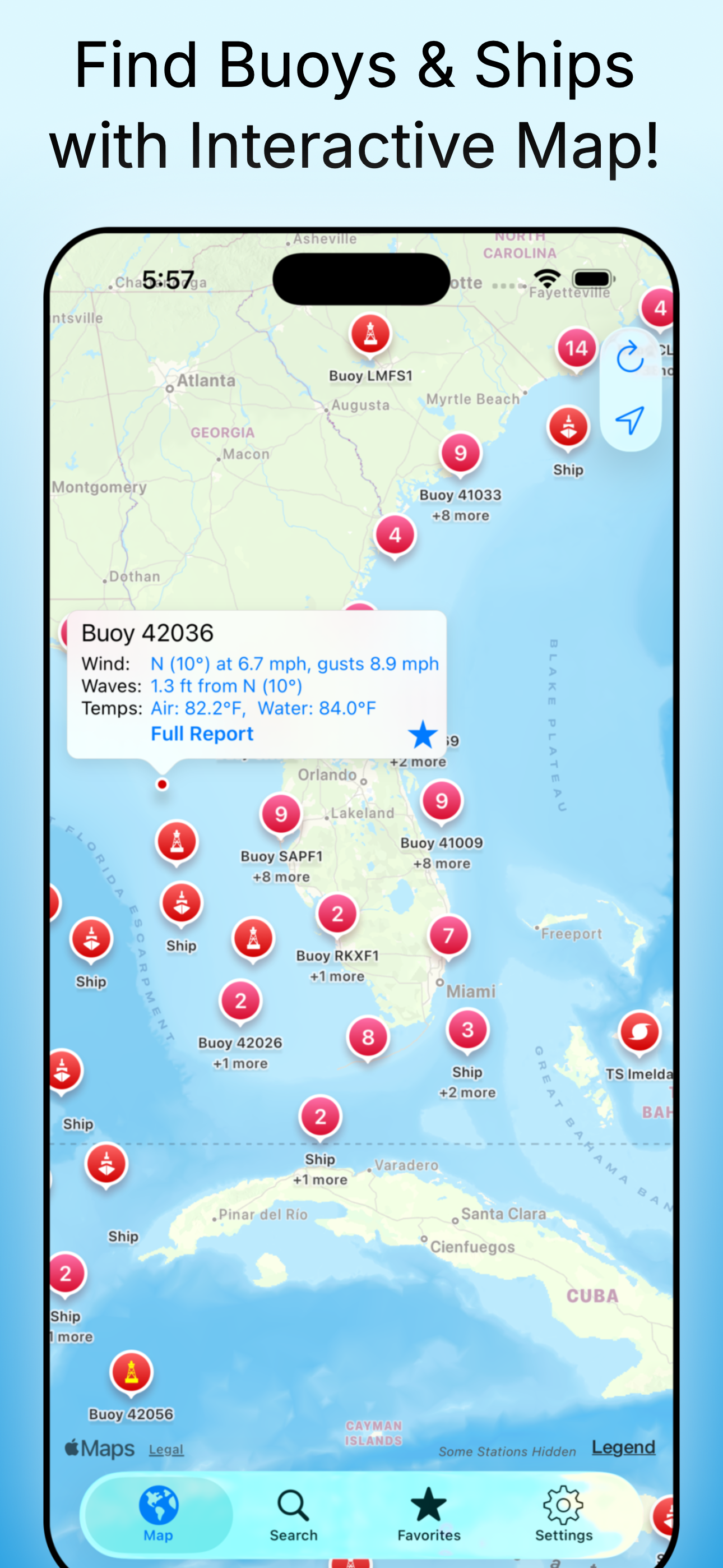
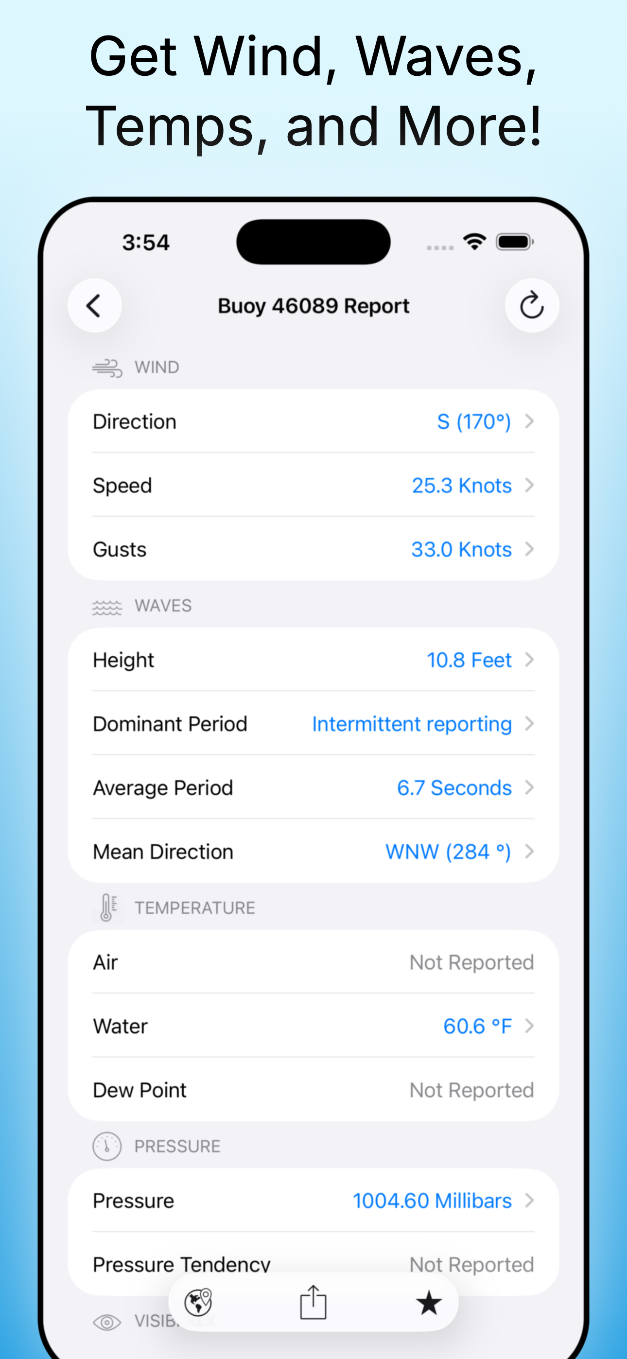
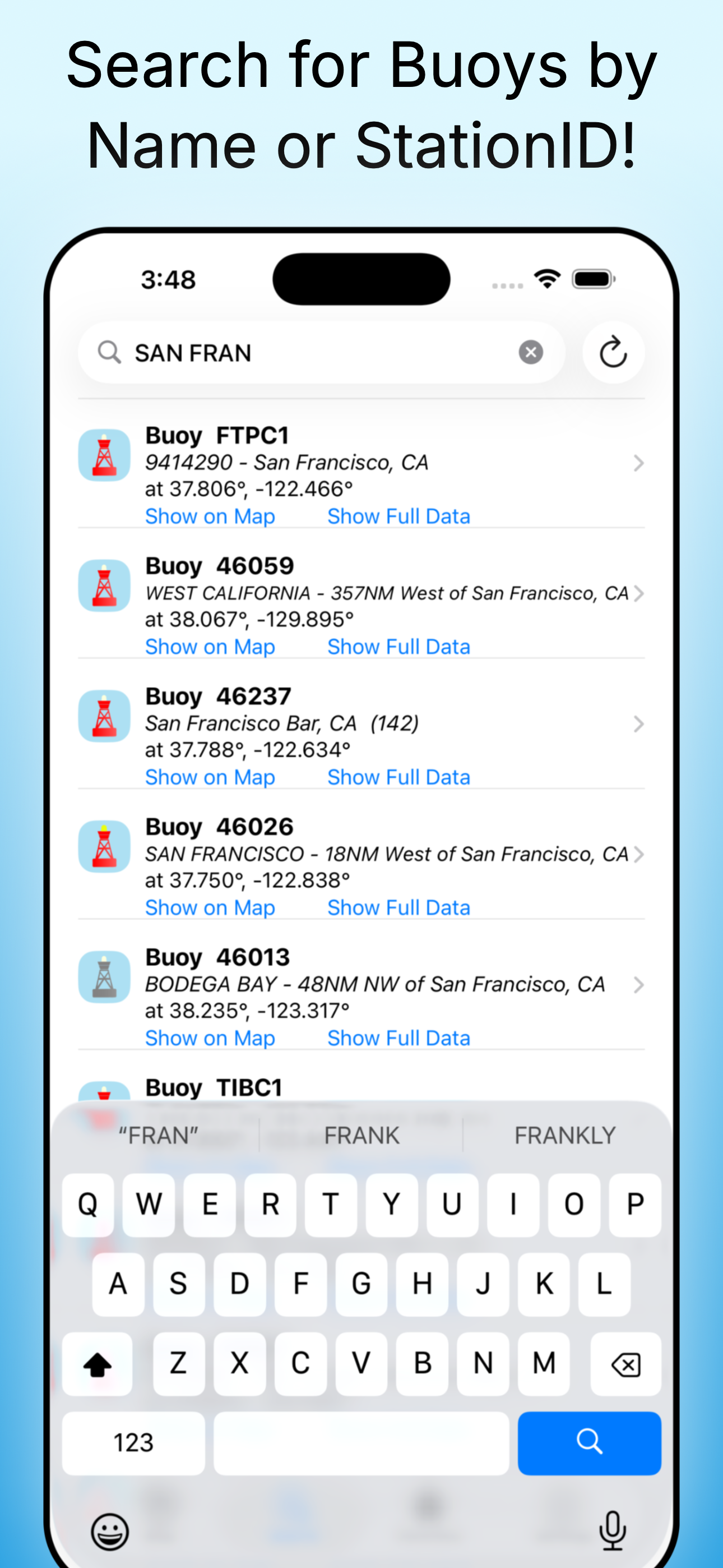
Clear Buoy Data at Your Fingertips
Simply tap any buoy or ship on the map to view its latest reported conditions. Tap again for a full summary or an interactive graph of recent trends, so you can see not only what's happening now, but how conditions have changed over time.
Add favorites to quickly view the locations that matter most to you, and monitor them anytime with the included widgets.
This app DOES NOT provide tide data, or maritime or other weather forecasts. There are dedicated apps for these from other publishers that do an excellent job. This app specializes exclusively in buoy and ship observation data.
Please note that not all buoys have all types of data available, and buoys do experience intermittent outages — a life at sea can be harsh!
Additionally, note that some buoys may be seasonal, and may be physically removed from the water during winter months, such as in the Great Lakes.
Raw source data courtesy of NOAA, the National Data Buoy Center (NDBC), and the National Hurricane Center (NHC).
Juggernaut Technology, Inc. is not associated with NOAA, NDBC, NHC, or any other government organization.
To learn more about NOAA Buoy (& Ship!) Reports, please read our How to use NOAA Buoy Reports guide.
You can contact us at info@NOAABuoyReports.com if you have any questions.
Download for Free Today!
Copyright 2015 - Juggernaut Technology, Inc. All Rights Reserved.
Quickly get the latest observations, recent history, and forecasts for most of the rivers, streams, and waterways that NOAA actively monitors in the USA with Rivercast. Check out our great map interface and interactive graphs!

Are you wiring new systems or rewiring old on your boat, RV, or car? Try WireSizer, our ABYC conforming wire gauge and voltage drop calculator!
Do you ever find yourself walking down a dock, scratching your head wondering, "Who made that boat?" Try HINSearchPlus, our Hull Identification Number lookup and more App!